
Newsletter
Categories
- All topics
- 360i
- 3d
- 3D digital twin
- 3D modeling
- Abraham Lincoln
- accessory
- accuracy
- Accurate Survey Data
- ADA
- AEC
- aerial
- affordable
- African American
- Agents of Discovery
- Agricultural optimization
- American
- analysis
- Android
- Apglos Survey Wizard
- apps
- APRIL2024
- APRIL2026
- ArcGIS
- architecture
- As-built
- ASCE
- Asset inventory
- Asset management
- AUG2023
- augmented reality
- avenza
- aviation
- awareness
- Bad Elf
- Bad Elf GPS
- base
- base and rover
- base/rover
- Bluetooth
- Brain Processes
- breaks
- Broad Street pump
- buffer
- bug fixes
- CAD
- Cartography
- cholera outbreak
- Christmas
- Clarice Starling
- Cognitive Maps
- Comic
- community
- Compliance
- Conference
- constellations
- construction
- construction professionals
- consultation
- coordinate systems
- CORS
- Cost Effective Surveying
- Cost Savings
- Custom GIS Solutions
- Custom Integration
- data collection
- data visualization
- datum
- DEC2023
- DEC2024
- Decision-making
- Design with Nature
- Digital Asset Mapping
- Digital delivery
- digital twin
- Dinosaur fossils
- Drone
- drones
- Ecological planning
- Ecology
- Economics
- Education
- Efficient Land Surveys
- Electric utility
- Ellen Churchill Semple
- enablement
- engineering
- environmental determinism
- Environmental stewardship
- epidemiology
- equity
- error
- Esri
- Esri ArcGIS
- Extreme Accuracy
- Facility management
- fatalities
- FEB2024
- FEB2026
- Field Maps
- field workers
- Fieldwork safety
- Firmware
- Flex
- Flex Mini
- ForeFlight
- Fossil location
- frequency
- fuel gauge
- GCP
- GCT
- Geodesy
- geography
- geoid
- geomatics
- geoprocessing
- geospatial
- Geospatial Data
- Geospatial Enablement Team
- geospatial professional
- Geospatial technology
- GET
- gis
- GIS implementation
- GIS solutions
- GIS Training
- GNSS
- GNSS receivers
- GPS
- GPS data collection
- GPS Integration
- Grid
- Ground
- ground control
- ground control targets
- Ground Penetrating Radar
- Halloween
- hazards
- high accuracy
- High Precision Survey
- high-accuracy
- history
- infrastructure
- injuries
- injury
- Inventor
- iOS
- JAN2024
- JAN2025
- jingle bells
- John Snow
- JULY2023
- JUNE2023
- JUNE2024
- JUNE2025
- land surveying
- Land surveyor
- land surveyors
- Land use
- Landscape architecture
- Laser
- Laser rangefinder
- LasterTech
- Layer cake analysis
- legacy
- LiDAR
- Local government
- LTI TruPulse 360i
- map
- Mapping
- MAR2025
- MARCH2024
- math
- mathematics
- MAY2023
- MAY2024
- May2025
- Mental Maps
- miasma theory
- Mock location
- Modernization
- Muhammad al-Idrisi
- NAD27
- NAD83
- NATRF2022
- navigation
- NDVI
- Newsletter
- NIR
- NMEA
- NOV2023
- NOV2024
- NTRIP
- oct2023
- oct2024
- OCT2025
- Offline
- Offset
- Operations Optimization
- paddle
- pairing
- Paleontological fieldwork
- Paleontology
- pilot
- Pix4D
- PIX4D Catch
- Pix4Dcatch
- planes
- planning
- portable
- PPE
- Precise Mapping
- precision
- Precision Mapping
- President
- prevention
- protocols
- public funding
- public health
- public works
- quickcapture
- radio
- Rangefinder
- real-time
- real-time data collection
- Real-time monitoring
- reality capture
- Regulatory compliance
- remote data collection
- right of way
- Roger Tomlinson
- rover
- RTK
- Safety
- Safety Optimization
- safety tips
- satellite
- scanning
- SDK
- SEPT2023
- SEPT2024
- SEPT2025
- Sign Management Solution
- signals
- Simplified GIS
- Site survey package
- slope
- Small organizations
- solutions
- song
- Spatial analysis
- Spatial Data
- spatial mapping
- ssp
- STEM
- Stratigraphy
- support
- survey
- survey-grade
- survey123
- surveying
- Surveying Technology
- Sustainability design
- Tabula Rogeriana
- tool
- topographic maps
- topology
- total stations
- training
- Training solutions
- transition plan
- Tree Inventory
- Tree Management Solution
- Tribrach
- Tribrachasaur
- tron
- Urban Planning
- User Friendly Survey App
- utilities
- Utility App
- utility design
- Utility pole measurements
- UTM
- Vegetation
- Washington DC
- Webmap
- WGS-84
- women
- workforce
- workplace
- workplace safety
- world
-


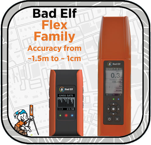
Right Tool for the Right Job

Bad Elf GNSS receivers like the Flex Mini and Flex Extreme help crews capture accurate location data fast when paired with apps like Esri Field Maps, PointMan, Pix4Dcatch, or Apglos Survey Wizard. The Flex Mini fits large deployments and versatile field work, while the Flex Extreme supports higher-accuracy jobs, rangefinder workflows, and rugged remote mapping.
-
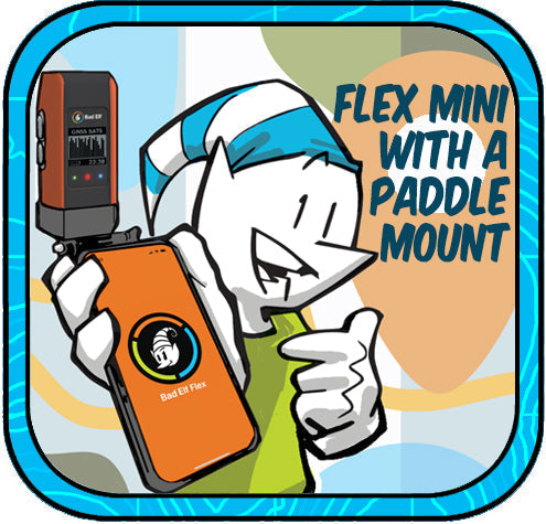

Flex Mini: Big GNSS Power in a Tiny Package
The Bad Elf Flex Mini is an affordable, high-accuracy GNSS receiver with RTK capability and a unique paddle mount that simplifies professional-grade mobile mapping for any smartphone or tablet.
-

Bad Elf Flex: GNSS Game Changer
Bad Elf Flex GNSS delivers high-precision mapping at a fraction of the cost, with transparent pricing, no annual fees, free USA-based support, and seamless Bluetooth connectivity to any device. Shop now at Bad Elf Webstore or contact sales@bad-elf.com for a quote or trial!
-
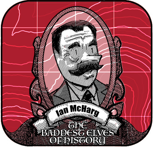

Ian McHarg: The Pioneer of Ecological Design
Discover Ian McHarg, the visionary landscape architect whose "layer cake" analysis method revolutionized landscape architecture, geography, and GIS development. His book Design with Nature laid the foundation for sustainable design and ecological planning, influencing modern practices and Esri founder Jack Dangermond. -


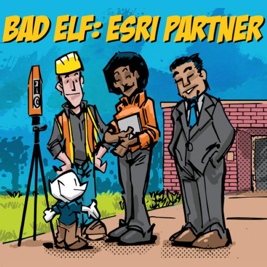
Esri User Conference - 2024
Bad Elf made a big splash at the Esri User Conference 2024, showcasing high-accuracy GPS solutions like the Bad Elf Flex and Flex Mini. The Flex delivers centimeter-level precision with RTK support and multi-band GNSS capabilities, while the Flex Mini offers sub-meter accuracy, perfect for mobile GIS applications. The team enjoyed meeting customers, taking Bad Elfies, and discussing innovative geospatial solutions. Inspired by the plenary session, Bad Elf is excited for the future of GIS. Check out our products and more on the Bad Elf website and webstore. -


Work Smarter, Not Harder
Esri Workforce is an effective tool for managing field operations in facility management, optimizing task assignments, and enhancing communication. It integrates seamlessly with other Esri apps and high-accuracy GPS devices like Bad Elf GNSS receivers, ensuring precise data for critical tasks. Despite some costs and connectivity dependencies, its real-time updates and user-friendly interface make it a top choice for improving efficiency and coordination.
-

Enhancing Accuracy with ESRI ArcGIS and High-Accuracy GNSS Receivers
In the realm of land surveying, traditional paper methods are giving way to digital innovations like ESRI ArcGIS and high-accuracy GNSS receivers. By integrating ArcGIS with GNSS technology, surveyors can achieve unmatched precision and efficiency. This synergy streamlines data collection, providing real-time insights and improving overall data integrity. Embrace the future of land surveying with ESRI ArcGIS and GNSS receivers, where accuracy and efficiency redefine the landscape of the industry.
-

Geospatial Enablement Team (GET)
Bad Elf is the premier geospatial enablement organization. Whether you need immediate support launching a digital, geospatial systems of record or you just need the best low-cost, high-accuracy GPS on the market, Bad Elf is here for you. Contact the Geospatial Enablement Team today.
-


We Came, We Saw, We Heard, We Conquered
The 2023 Esri User Conference was a great success for Bad Elf LLC. We met with many customers and partners, learned about the latest trends in GIS technology, and came away with a lot of new ideas. We look forward to attending again next year. -


Don't Miss the Epic Bad Elf Booth at the Esri User Conference!
Hey there, fellow geospatial enthusiasts! If you're using Bad Elf GPS and Esri GIS software, we've got something extraordinary in store for you at the Esri Users Conference. Prepare yourself for a unique, funny, and downright awesome experience that you won't find anywhere else. -


Laser Offsets
Using high-accuracy Bad Elf GPS integrated with a laser offset rangefinder is an exceptional method for collecting remote data due to several key advantages. -
March 2023 Newsletter - HERE, HERE!
In this newsletter we cover topics that include
- Datums
- Custom Esri ArcGIS Fields for Field Maps and QuickCapture
- Bad Elf Ortho Everywhere tool
- Tilt filtered points


