Newsletter
Categories
- All topics
- 360i
- 3d
- 3D digital twin
- 3D modeling
- Abraham Lincoln
- accessory
- accuracy
- Accurate Survey Data
- ADA
- AEC
- aerial
- affordable
- African American
- Agents of Discovery
- Agricultural optimization
- American
- analysis
- Android
- Apglos Survey Wizard
- apps
- APRIL2024
- APRIL2026
- ArcGIS
- architecture
- As-built
- ASCE
- Asset inventory
- Asset management
- AUG2023
- augmented reality
- avenza
- aviation
- awareness
- Bad Elf
- Bad Elf GPS
- base
- base and rover
- base/rover
- Bluetooth
- Brain Processes
- breaks
- Broad Street pump
- buffer
- bug fixes
- CAD
- Cartography
- cholera outbreak
- Christmas
- Clarice Starling
- Cognitive Maps
- Comic
- community
- Compliance
- Conference
- constellations
- construction
- construction professionals
- consultation
- coordinate systems
- CORS
- Cost Effective Surveying
- Cost Savings
- Custom GIS Solutions
- Custom Integration
- data collection
- data visualization
- datum
- DEC2023
- DEC2024
- Decision-making
- Design with Nature
- Digital Asset Mapping
- Digital delivery
- digital twin
- Dinosaur fossils
- Drone
- drones
- Ecological planning
- Ecology
- Economics
- Education
- Efficient Land Surveys
- Electric utility
- Ellen Churchill Semple
- enablement
- engineering
- environmental determinism
- Environmental stewardship
- epidemiology
- equity
- error
- Esri
- Esri ArcGIS
- Extreme Accuracy
- Facility management
- fatalities
- FEB2024
- FEB2026
- Field Maps
- field workers
- Fieldwork safety
- Firmware
- Flex
- Flex Mini
- ForeFlight
- Fossil location
- frequency
- fuel gauge
- GCP
- GCT
- Geodesy
- geography
- geoid
- geomatics
- geoprocessing
- geospatial
- Geospatial Data
- Geospatial Enablement Team
- geospatial professional
- Geospatial technology
- GET
- gis
- GIS implementation
- GIS solutions
- GIS Training
- GNSS
- GNSS receivers
- GPS
- GPS data collection
- GPS Integration
- Grid
- Ground
- ground control
- ground control targets
- Ground Penetrating Radar
- Halloween
- hazards
- high accuracy
- High Precision Survey
- high-accuracy
- history
- infrastructure
- injuries
- injury
- Inventor
- iOS
- JAN2024
- JAN2025
- jingle bells
- John Snow
- JULY2023
- JUNE2023
- JUNE2024
- JUNE2025
- land surveying
- Land surveyor
- land surveyors
- Land use
- Landscape architecture
- Laser
- Laser rangefinder
- LasterTech
- Layer cake analysis
- legacy
- LiDAR
- Local government
- LTI TruPulse 360i
- map
- Mapping
- MAR2025
- MARCH2024
- math
- mathematics
- MAY2023
- MAY2024
- May2025
- Mental Maps
- miasma theory
- Mock location
- Modernization
- Muhammad al-Idrisi
- NAD27
- NAD83
- NATRF2022
- navigation
- NDVI
- Newsletter
- NIR
- NMEA
- NOV2023
- NOV2024
- NTRIP
- oct2023
- oct2024
- OCT2025
- Offline
- Offset
- Operations Optimization
- paddle
- pairing
- Paleontological fieldwork
- Paleontology
- pilot
- Pix4D
- PIX4D Catch
- Pix4Dcatch
- planes
- planning
- portable
- PPE
- Precise Mapping
- precision
- Precision Mapping
- President
- prevention
- protocols
- public funding
- public health
- public works
- quickcapture
- radio
- Rangefinder
- real-time
- real-time data collection
- Real-time monitoring
- reality capture
- Regulatory compliance
- remote data collection
- right of way
- Roger Tomlinson
- rover
- RTK
- Safety
- Safety Optimization
- safety tips
- satellite
- scanning
- SDK
- SEPT2023
- SEPT2024
- SEPT2025
- Sign Management Solution
- signals
- Simplified GIS
- Site survey package
- slope
- Small organizations
- solutions
- song
- Spatial analysis
- Spatial Data
- spatial mapping
- ssp
- STEM
- Stratigraphy
- support
- survey
- survey-grade
- survey123
- surveying
- Surveying Technology
- Sustainability design
- Tabula Rogeriana
- tool
- topographic maps
- topology
- total stations
- training
- Training solutions
- transition plan
- Tree Inventory
- Tree Management Solution
- Tribrach
- Tribrachasaur
- tron
- Urban Planning
- User Friendly Survey App
- utilities
- Utility App
- utility design
- Utility pole measurements
- UTM
- Vegetation
- Washington DC
- Webmap
- WGS-84
- women
- workforce
- workplace
- workplace safety
- world
-
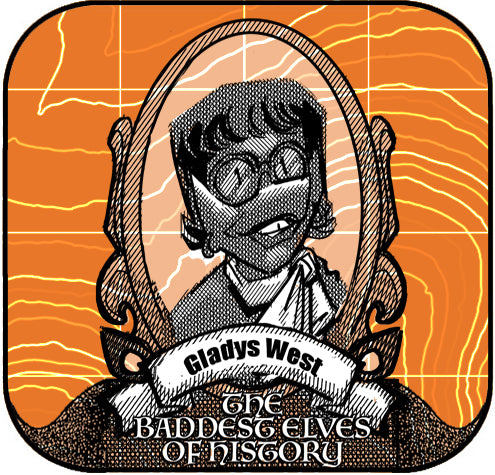

Baddest Elves of History - Gladys West

Gladys West's pioneering work on the mathematical modeling of the Earth's shape and satellite data analysis significantly enhanced GPS technology, enabling precise geospatial applications across various industries, and her legacy continues to influence modern tools like the Bad Elf Flex and inspire the geospatial community.
-


Esri User Conference - 2024
Bad Elf made a big splash at the Esri User Conference 2024, showcasing high-accuracy GPS solutions like the Bad Elf Flex and Flex Mini. The Flex delivers centimeter-level precision with RTK support and multi-band GNSS capabilities, while the Flex Mini offers sub-meter accuracy, perfect for mobile GIS applications. The team enjoyed meeting customers, taking Bad Elfies, and discussing innovative geospatial solutions. Inspired by the plenary session, Bad Elf is excited for the future of GIS. Check out our products and more on the Bad Elf website and webstore. -


Geospatially Enabling Young Organizations
Young NGO, big dreams, zero GPS clue. Paper maps crumple in sweaty hands, data scattered like leaves in a hurricane. Enter the Bad Elf GET team, geospatial ninjas dropping in with tech that's sleek, not clunky. Drones buzz, smartphones sing, data flows like a digital dream. Boundaries mapped, resources pinpointed, communities empowered. From scribbles to systems, impact takes flight. No more time lost, GET mapping today. The future's green, and it's geo-enabled.
-


Lost in Geo-Jargon? Bad Elf's GET to the Rescue!
 Navigating the complexities of the geospatial industries? Let Bad Elf's Geospatial Enablement Team (GET) be your cartographer to success. Our experienced professionals offer comprehensive services to empower your journey, from deciphering terminology to implementing cutting-edge solutions.
 -


Bad Elf Flex Mini, there isn’t anything mini about it except the size!
Ditch bulky baggage and embrace the mighty mini: Bad Elf Flex Mini packs pro-grade geospatial precision into a pocket-sized powerhouse. -


Geoprocessing Tool: Buffering in GIS and Land Surveying
Buffering in GIS (Geographic Information Systems) and land surveying is a geoprocessing operation that involves creating a zone or area around a geographic feature. -

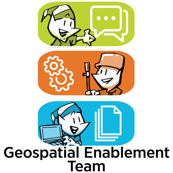
Geospatial Enablement Team (GET)
Bad Elf is the premier geospatial enablement organization. Whether you need immediate support launching a digital, geospatial systems of record or you just need the best low-cost, high-accuracy GPS on the market, Bad Elf is here for you. Contact the Geospatial Enablement Team today.
-

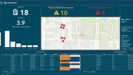
Sign Management for Local Governments
Empower your municipality with the Bad Elf GNSS and the Esri ArcGIS Online Sign Management solution. Say goodbye to paper maps and outdated databases as we transition your workflow to a digital platform with our hardware and training services.
-

Tree Inventory
Tree inventories hold significant importance for organizations, communities, and individuals due to the numerous benefits that trees provide to the environment. -


How to set ground control for drone operations
Setting ground control points (GCPs) is an essential step for achieving high-accuracy mapping drone flights. -
April 2023 Newsletter - HERE, HERE!
April 2023 Newsletter - HERE, HERE!
- Checklist workflows
- Safety
- Quote Corner
-