Flex Mini: Big GNSS Power in a Tiny Package


Precision meets portability. The Bad Elf Flex Mini delivers survey-grade accuracy in a compact, budget-friendly design. Whether you’re a seasoned GIS pro or just getting started, the Flex Mini simplifies high-accuracy mapping. AND no bulky gear, no complicated workflows!
Accuracy on Your Terms:
- Flex Mini Standard: Submeter accuracy out of the box
-
Flex Mini Extreme: RTK-ready for centimeter-level precision via correction networks
-
Multi-constellation GNSS: GPS, GLONASS, Galileo, BeiDou, SBAS
- Update rate: 10Hz
- Battery life: ~24 hours (depending on use and corrections)
Use Any Phone or Tablet. The Flex Mini pairs via Bluetooth to iOS, Android, or Windows phones and tablets. Use your favorite apps:
- Esri Field Maps
- Esri Survey123
- Pix4Dcatch
- vGIS
- PointMan
- Avenza Maps
- OnStation
- Ecobot
- Fulcrum
- Apglos Survey Wizard
- QField
- and more
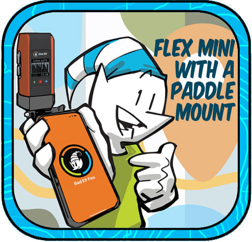
The Paddle Mount is a Game-Changer. Forget the juggling act. The Bad Elf Paddle Mount turns a three-handed job into a one-handed breeze:
-
Mounts your phone or tablet securely below the Bad Elf Flex Mini, perfectly balanced
-
Designed for 1.25" poles
-
Works with most LTE devices using an adjustable clamp
-
Keeps your screen in view while you collect, navigate, or QA data
- Built for rugged use: lightweight, tough, and field-ready
Built for any job. The Flex Mini is ideal for:
-
Subsurface utility mapping (SUE)
-
Tree inventory and urban forestry
-
Asset management and inspection
-
Environmental monitoring
-
Emergency response and disaster recovery
- Construction layout and QA
Affordable. Versatile. Accurate. The Flex Mini delivers pro-grade GNSS accuracy without pro-grade price tags. The Extreme version connects easily to RTK networks like PointOne, UNAVCO, and state RTNs for centimeter-level results without expensive survey crews or complex setups!
Mapping has never been this easy, fast, or accessible. Ready to streamline your next mapping project? Email get@bad-elf.com to learn how the Flex Mini + Paddle Mount can revolutionize your geospatial fieldwork.


Dr. Smilovsky is the Geospatial Solutions Director for Bad Elf, a GNSS technologies company. Dr S is a faculty member at Arizona State University teaching various GIS and design classes. He is a certified Geographic Information Systems Professional, a certified Arborist, and a Part 107 certified UAV pilot. As a geospatial evangelist, custom geospatial solutions provider, and geographic researcher Dr. S is widely versed in all things geodetic. He is a proud Geoholic!