
Newsletter
Categories
- All topics
- 360i
- 3d
- 3D digital twin
- 3D modeling
- Abraham Lincoln
- accessory
- accuracy
- Accurate Survey Data
- ADA
- AEC
- aerial
- affordable
- African American
- Agents of Discovery
- Agricultural optimization
- American
- analysis
- Android
- Apglos Survey Wizard
- apps
- APRIL2024
- APRIL2026
- ArcGIS
- architecture
- As-built
- ASCE
- Asset inventory
- Asset management
- AUG2023
- augmented reality
- avenza
- aviation
- awareness
- Bad Elf
- Bad Elf GPS
- base
- base and rover
- base/rover
- Bluetooth
- Brain Processes
- breaks
- Broad Street pump
- buffer
- bug fixes
- CAD
- Cartography
- cholera outbreak
- Christmas
- Clarice Starling
- Cognitive Maps
- Comic
- community
- Compliance
- Conference
- constellations
- construction
- construction professionals
- consultation
- coordinate systems
- CORS
- Cost Effective Surveying
- Cost Savings
- Custom GIS Solutions
- Custom Integration
- data collection
- data visualization
- datum
- DEC2023
- DEC2024
- Decision-making
- Design with Nature
- Digital Asset Mapping
- Digital delivery
- digital twin
- Dinosaur fossils
- Drone
- drones
- Ecological planning
- Ecology
- Economics
- Education
- Efficient Land Surveys
- Electric utility
- Ellen Churchill Semple
- enablement
- engineering
- environmental determinism
- Environmental stewardship
- epidemiology
- equity
- error
- Esri
- Esri ArcGIS
- Extreme Accuracy
- Facility management
- fatalities
- FEB2024
- FEB2026
- Field Maps
- field workers
- Fieldwork safety
- Firmware
- Flex
- Flex Mini
- ForeFlight
- Fossil location
- frequency
- fuel gauge
- GCP
- GCT
- Geodesy
- geography
- geoid
- geomatics
- geoprocessing
- geospatial
- Geospatial Data
- Geospatial Enablement Team
- geospatial professional
- Geospatial technology
- GET
- gis
- GIS implementation
- GIS solutions
- GIS Training
- GNSS
- GNSS receivers
- GPS
- GPS data collection
- GPS Integration
- Grid
- Ground
- ground control
- ground control targets
- Ground Penetrating Radar
- Halloween
- hazards
- high accuracy
- High Precision Survey
- high-accuracy
- history
- infrastructure
- injuries
- injury
- Inventor
- iOS
- JAN2024
- JAN2025
- jingle bells
- John Snow
- JULY2023
- JUNE2023
- JUNE2024
- JUNE2025
- land surveying
- Land surveyor
- land surveyors
- Land use
- Landscape architecture
- Laser
- Laser rangefinder
- LasterTech
- Layer cake analysis
- legacy
- LiDAR
- Local government
- LTI TruPulse 360i
- map
- Mapping
- MAR2025
- MARCH2024
- math
- mathematics
- MAY2023
- MAY2024
- May2025
- Mental Maps
- miasma theory
- Mock location
- Modernization
- Muhammad al-Idrisi
- NAD27
- NAD83
- NATRF2022
- navigation
- NDVI
- Newsletter
- NIR
- NMEA
- NOV2023
- NOV2024
- NTRIP
- oct2023
- oct2024
- OCT2025
- Offline
- Offset
- Operations Optimization
- paddle
- pairing
- Paleontological fieldwork
- Paleontology
- pilot
- Pix4D
- PIX4D Catch
- Pix4Dcatch
- planes
- planning
- portable
- PPE
- Precise Mapping
- precision
- Precision Mapping
- President
- prevention
- protocols
- public funding
- public health
- public works
- quickcapture
- radio
- Rangefinder
- real-time
- real-time data collection
- Real-time monitoring
- reality capture
- Regulatory compliance
- remote data collection
- right of way
- Roger Tomlinson
- rover
- RTK
- Safety
- Safety Optimization
- safety tips
- satellite
- scanning
- SDK
- SEPT2023
- SEPT2024
- SEPT2025
- Sign Management Solution
- signals
- Simplified GIS
- Site survey package
- slope
- Small organizations
- solutions
- song
- Spatial analysis
- Spatial Data
- spatial mapping
- ssp
- STEM
- Stratigraphy
- support
- survey
- survey-grade
- survey123
- surveying
- Surveying Technology
- Sustainability design
- Tabula Rogeriana
- tool
- topographic maps
- topology
- total stations
- training
- Training solutions
- transition plan
- Tree Inventory
- Tree Management Solution
- Tribrach
- Tribrachasaur
- tron
- Urban Planning
- User Friendly Survey App
- utilities
- Utility App
- utility design
- Utility pole measurements
- UTM
- Vegetation
- Washington DC
- Webmap
- WGS-84
- women
- workforce
- workplace
- workplace safety
- world
-


Ellen Churchill Semple

Ellen Churchill Semple was a pioneering American geographer who advanced environmental determinism, broke barriers for women in STEM, and laid conceptual foundations for modern geographic information systems (GIS).
-


Flex Mini: Big GNSS Power in a Tiny Package
The Bad Elf Flex Mini is an affordable, high-accuracy GNSS receiver with RTK capability and a unique paddle mount that simplifies professional-grade mobile mapping for any smartphone or tablet.
-


The Baddest Elves of History
John Snow, a pioneering 19th-century epidemiologist, revolutionized public health by using spatial mapping to trace the source of London's 1854 cholera outbreak. His innovative mapping of cholera cases around the Broad Street pump demonstrated the power of geographic analysis, laying the foundation for modern Geographic Information Systems (GIS). Snow’s work continues to influence epidemiology and GIS, showcasing the importance of spatial data in solving real-world challenges.
-
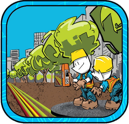

A Modern Solution for 3D Digital Twin and Augmented Reality
City utility workers can now locate buried assets with unmatched precision using the Bad Elf Flex Extreme GNSS receiver paired with the Pix4Dcatch app. This innovative solution combines centimeter-level GNSS accuracy, real-time 3D scanning, and augmented reality to superimpose GIS data onto live views for efficient field operations. By creating detailed 3D digital twins and enhancing workflows, this technology revolutionizes asset management and infrastructure maintenance.
-
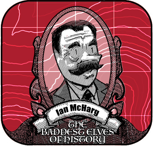

Ian McHarg: The Pioneer of Ecological Design
Discover Ian McHarg, the visionary landscape architect whose "layer cake" analysis method revolutionized landscape architecture, geography, and GIS development. His book Design with Nature laid the foundation for sustainable design and ecological planning, influencing modern practices and Esri founder Jack Dangermond. -


Digital Twinning with the Bad Elf Flex and PIX4Dcatch
The use of the Bad Elf Flex Extreme and PIX4Dcatch enhances a development project by employing digital twin technology and advanced GIS and CAD integrations for precise mapping, real-time construction monitoring, and efficient project management through innovative surveying and digital delivery methods. -


Roger Tomlinson: The Father of GIS
Roger Tomlinson, known as the father of Geographic Information Systems (GIS), revolutionized the way we understand and interact with spatial data. Born in Cambridge, England, in 1933, Tomlinson pursued geography and earned degrees from multiple institutions, including Nottingham University, McGill University, and the University of London. His academic focus was primarily on geography, geology, and land use, which laid the foundation for his groundbreaking work. -
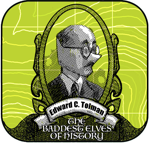

The Baddest Elves in History: Edward C Tolman
Today, GIS works like our brain's mental maps. Just as rats navigate mazes, GIS tools help us interpret spatial data, driving smarter decisions in urban planning, ecology, and economics. Understanding how we map environments leads to designing better communities and solving modern challenges. -


Esri User Conference - 2024
Bad Elf made a big splash at the Esri User Conference 2024, showcasing high-accuracy GPS solutions like the Bad Elf Flex and Flex Mini. The Flex delivers centimeter-level precision with RTK support and multi-band GNSS capabilities, while the Flex Mini offers sub-meter accuracy, perfect for mobile GIS applications. The team enjoyed meeting customers, taking Bad Elfies, and discussing innovative geospatial solutions. Inspired by the plenary session, Bad Elf is excited for the future of GIS. Check out our products and more on the Bad Elf website and webstore. -


Dangling Nodes Say What!?
Understanding topology in geography is crucial for ensuring accurate spatial relationships between features, preventing common errors like dangling nodes, overlapping polygons, and misaligned boundaries. By fixing these errors, we create reliable maps that enhance navigation, planning, and data analysis, making geographic data more effective and trustworthy.
-


Enhancing Accuracy with ESRI ArcGIS and High-Accuracy GNSS Receivers
In the realm of land surveying, traditional paper methods are giving way to digital innovations like ESRI ArcGIS and high-accuracy GNSS receivers. By integrating ArcGIS with GNSS technology, surveyors can achieve unmatched precision and efficiency. This synergy streamlines data collection, providing real-time insights and improving overall data integrity. Embrace the future of land surveying with ESRI ArcGIS and GNSS receivers, where accuracy and efficiency redefine the landscape of the industry.
-
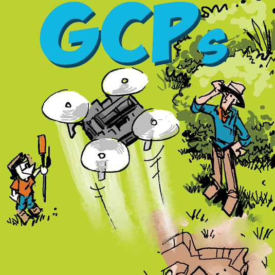

Hitting the Target: Setting Ground Control with Bad Elf Flex
Setting ground control targets with the Bad Elf Flex GNSS significantly enhances the accuracy of drone data collection. This method ensures aerial survey data is precise, reliable, and aligns with real-world coordinates.


