Access Denied
IMPORTANT! If you’re a store owner, please make sure you have Customer accounts enabled in your Store Admin, as you have customer based locks set up with EasyLockdown app. Enable Customer Accounts
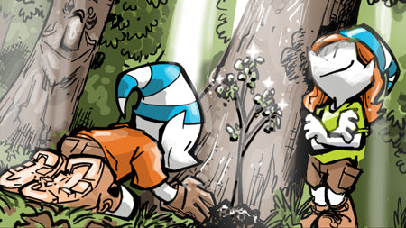
Tree Inventory
Author
Nikolas Smilovsky


Trees also have a significant influence on the water cycle. They help regulate water runoff and prevent soil erosion by intercepting rainfall with their canopies, reducing the risk of flooding and protecting water quality. Trees also play a role in groundwater recharge by allowing water to infiltrate into the soil, replenishing underground water sources. Moreover, trees provide vital habitats for a diverse range of wildlife, supporting biodiversity and ecological balance. They offer shelter, food, and nesting sites for various species, contributing to the preservation of local ecosystems and enhancing overall ecological resilience.
From a human perspective, trees offer numerous benefits. They provide shade, reducing the heat island effect in urban areas and helping to lower energy consumption for cooling. Trees also improve the aesthetic appeal of landscapes, enhancing the quality of life in communities and attracting tourism.
Having an inventory of trees is a crucial starting point for managing and maximizing these benefits. It allows organizations, communities, and individuals to gain a comprehensive understanding of the tree population in a particular area, including species, size, condition, and location. This information is essential for strategic planning, conservation efforts, urban development, and resource management.
To achieve accurate and high-quality tree inventories, utilizing tools like the Bad Elf Flex GNSS receiver for high-accuracy field data collection is highly recommended. This device enables precise and reliable geolocation data, ensuring accurate mapping of trees and facilitating efficient data collection in the field.
It is worth mentioning that in certain areas, tree inventories are required prior to onsite construction. These inventories ensure that the impact of construction activities on trees is adequately assessed and mitigated. By having detailed information about the tree population, developers can make informed decisions and implement measures to protect and preserve trees during construction, contributing to sustainable and environmentally responsible development practices.
For more information on using a Bad Elf Flex to complete a tree inventory please watch our Arbor Day video special from 2021. In this video we review how to use Esri Survey123 and a Bad Elf Flex to complete a comprehensive tree inventory.
But how can private organizations and local governments efficiently streamline their tree inspection and inventory workflows of their most plentiful asset? Introducing Bad Elf GNSS receivers with ArcGIS Field Maps custom form calculations.
Bad Elf GNSS receivers are cutting-edge tools that revolutionize the way urban forests are managed. These receivers provide high-accuracy location data, allowing you to precisely pinpoint the position of each tree in your inventory. Bad Elf’s receivers integrate seamlessly with custom form calculations in ArcGIS Field Maps. With this powerful combination, you can streamline your tree inspection and inventory workflows like never before. The custom form calculation software is designed specifically for tree management. It enables you to capture essential information about each tree, such as its species, size, condition, and maintenance needs, all in one place.
By utilizing the Bad Elf GNSS receiver, you maximize accuracy even under canopy when recording tree locations. Simply walk up to a tree, gather its information using the form, and let the receiver automatically capture its precise location. When connected to a RTK network, you can expect sub-foot accuracy to survey grade. This streamlined workflow saves you time and ensures accurate data collection, allowing you to quickly build a comprehensive tree inventory.
But the benefits don't stop there. The Tree Management solution powered by Bad Elf GNSS receivers also enables you to schedule routine inspections and maintenance assignments. With real-time data at your fingertips, you can easily prioritize tasks, ensuring the health and longevity of your urban forest.
The solution allows you to engage employees and volunteers in the tree management process. Volunteers can use the custom form calculation software on their mobile devices, contributing to the inventory and inspection efforts, fostering community involvement. With Bad Elf GNSS receivers and custom form calculation software, you can streamline your tree inspection and inventory workflows, effectively manage your urban forest, and plan improvements for a greener and more resilient future.
Discover the power of Bad Elf GNSS receivers and transform the way you manage your trees today. You can also email sales@bad-elf.com if you have any questions or would like to discuss completing a tree inventory with one of our specialists. Happy mapping!
Nikolas Smilovsky
Dr. Smilovsky is the Geospatial Solutions Director for Bad Elf, a GNSS technologies company. Dr S is a faculty member at Arizona State University teaching various GIS and design classes. He is a certified Geographic Information Systems Professional, a certified Arborist, and a Part 107 certified UAV pilot. As a geospatial evangelist, custom geospatial solutions provider, and geographic researcher Dr. S is widely versed in all things geodetic. He is a proud Geoholic!
Invalid password
Enter
Use left/right arrows to navigate the slideshow or swipe left/right if using a mobile device