A Modern Solution for 3D Digital Twin and Augmented Reality

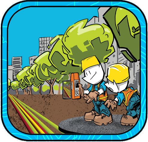
A city utility worker needs to locate buried assets accurately and efficiently.
Bad Elf Flex Extreme GNSS
The Bad Elf Flex Extreme is a high-performance GNSS receiver designed for GIS, mapping, and surveying applications. Key Features:
-
Multi-Constellation Support: Compatible with GPS, GLONASS, BeiDou, Galileo, and QZSS.
-
High Accuracy: Achieves centimeter-level accuracy with RTK corrections.
-
Versatility: Works seamlessly with iOS, Android, and Windows devices.
Pix4Dcatch
Pix4Dcatch is a mobile application that transforms your device into a professional 3D scanner, enabling the capture of accurate 3D models and maps. Key Features:
-
Real-Time 3D Capture: Provides live feedback during data collection.
-
Augmented Reality (AR) Visualization: Overlays georeferenced 3D models onto the real world for immediate analysis.
-
RTK Compatibility: Supports integration with RTK devices like the Bad Elf Flex for enhanced accuracy.
The Field Operation
Equipped with the Bad Elf Flex Extreme GNSS receiver and the Pix4Dcatch app on a tablet, the utility worker embarks on the task.
-
Setup: The worker pairs the Bad Elf Flex Extreme with the tablet via Bluetooth, ensuring a stable connection.
-
RTK Initialization: Connecting the Bad Elf Flex app to an RTK network provides real-time corrections, enabling centimeter-level accuracy.
-
Data Capture: Using Pix4Dcatch, the worker scans the area, capturing high-resolution images and LiDAR data.
-
AR Visualization: Pix4Dcatch's AR feature overlays existing GIS data onto the live camera view, guiding the worker to the precise location of the buried asset.
-
3D Modeling: The collected data is processed to create a detailed 3D digital twin of the site, documenting the asset's exact position and surrounding environment.
This integration of advanced GNSS technology with real-time data capture and augmented reality streamlines the utility worker's task, enhancing accuracy and efficiency in locating and documenting underground assets.


Dr. Smilovsky is the Geospatial Solutions Director for Bad Elf, a GNSS technologies company. Dr S is a faculty member at Arizona State University teaching various GIS and design classes. He is a certified Geographic Information Systems Professional, a certified Arborist, and a Part 107 certified UAV pilot. As a geospatial evangelist, custom geospatial solutions provider, and geographic researcher Dr. S is widely versed in all things geodetic. He is a proud Geoholic!