
Newsletter
Categories
- 360i
- 3d
- 3D digital twin
- 3D modeling
- Abraham Lincoln
- accessory
- accuracy
- Accurate Survey Data
- ADA
- AEC
- aerial
- affordable
- African American
- Agents of Discovery
- Agricultural optimization
- American
- analysis
- Android
- Apglos Survey Wizard
- apps
- APRIL2024
- APRIL2026
- ArcGIS
- architecture
- As-built
- ASCE
- Asset inventory
- Asset management
- AUG2023
- augmented reality
- avenza
- aviation
- awareness
- Bad Elf
- Bad Elf GPS
- base
- base and rover
- base/rover
- Bluetooth
- Brain Processes
- breaks
- Broad Street pump
- buffer
- bug fixes
- CAD
- Cartography
- cholera outbreak
- Christmas
- Clarice Starling
- Cognitive Maps
- Comic
- community
- Compliance
- Conference
- constellations
- construction
- construction professionals
- consultation
- coordinate systems
- CORS
- Cost Effective Surveying
- Cost Savings
- Custom GIS Solutions
- Custom Integration
- data collection
- data visualization
- datum
- DEC2023
- DEC2024
- Decision-making
- Design with Nature
- Digital Asset Mapping
- Digital delivery
- digital twin
- Dinosaur fossils
- Drone
- drones
- Ecological planning
- Ecology
- Economics
- Education
- Efficient Land Surveys
- Electric utility
- Ellen Churchill Semple
- enablement
- engineering
- environmental determinism
- Environmental stewardship
- epidemiology
- equity
- error
- Esri
- Esri ArcGIS
- Extreme Accuracy
- Facility management
- fatalities
- FEB2024
- FEB2026
- Field Maps
- field workers
- Fieldwork safety
- Firmware
- Flex
- Flex Mini
- ForeFlight
- Fossil location
- frequency
- fuel gauge
- GCP
- GCT
- Geodesy
- geography
- geoid
- geomatics
- geoprocessing
- geospatial
- Geospatial Data
- Geospatial Enablement Team
- geospatial professional
- Geospatial technology
- GET
- gis
- GIS implementation
- GIS solutions
- GIS Training
- GNSS
- GNSS receivers
- GPS
- GPS data collection
- GPS Integration
- Grid
- Ground
- ground control
- ground control targets
- Ground Penetrating Radar
- Halloween
- hazards
- high accuracy
- High Precision Survey
- high-accuracy
- history
- infrastructure
- injuries
- injury
- Inventor
- iOS
- JAN2024
- JAN2025
- jingle bells
- John Snow
- JULY2023
- JUNE2023
- JUNE2024
- JUNE2025
- land surveying
- Land surveyor
- land surveyors
- Land use
- Landscape architecture
- Laser
- Laser rangefinder
- LasterTech
- Layer cake analysis
- legacy
- LiDAR
- Local government
- LTI TruPulse 360i
- map
- Mapping
- MAR2025
- MARCH2024
- math
- mathematics
- MAY2023
- MAY2024
- May2025
- Mental Maps
- miasma theory
- Mock location
- Modernization
- Muhammad al-Idrisi
- NAD27
- NAD83
- NATRF2022
- navigation
- NDVI
- Newsletter
- NIR
- NMEA
- NOV2023
- NOV2024
- NTRIP
- oct2023
- oct2024
- OCT2025
- Offline
- Offset
- Operations Optimization
- paddle
- pairing
- Paleontological fieldwork
- Paleontology
- pilot
- Pix4D
- PIX4D Catch
- Pix4Dcatch
- planes
- planning
- portable
- PPE
- Precise Mapping
- precision
- Precision Mapping
- President
- prevention
- protocols
- public funding
- public health
- public works
- quickcapture
- radio
- Rangefinder
- real-time
- real-time data collection
- Real-time monitoring
- reality capture
- Regulatory compliance
- remote data collection
- right of way
- Roger Tomlinson
- rover
- RTK
- Safety
- Safety Optimization
- safety tips
- satellite
- scanning
- SDK
- SEPT2023
- SEPT2024
- SEPT2025
- Sign Management Solution
- signals
- Simplified GIS
- Site survey package
- slope
- Small organizations
- solutions
- song
- Spatial analysis
- Spatial Data
- spatial mapping
- ssp
- STEM
- Stratigraphy
- support
- survey
- survey-grade
- survey123
- surveying
- Surveying Technology
- Sustainability design
- Tabula Rogeriana
- tool
- topographic maps
- topology
- total stations
- training
- Training solutions
- transition plan
- Tree Inventory
- Tree Management Solution
- Tribrach
- Tribrachasaur
- tron
- Urban Planning
- User Friendly Survey App
- utilities
- Utility App
- utility design
- Utility pole measurements
- UTM
- Vegetation
- Washington DC
- Webmap
- WGS-84
- women
- workforce
- workplace
- workplace safety
- world
-


Flex Mini: Big GNSS Power in a Tiny Package

The Bad Elf Flex Mini is an affordable, high-accuracy GNSS receiver with RTK capability and a unique paddle mount that simplifies professional-grade mobile mapping for any smartphone or tablet.
-


Unlock Precision and Confidence with the Bad Elf Site Survey Package
The Bad Elf Site Survey Package (SSP) delivers an affordable, high-accuracy GNSS solution with customized hardware, expert training, and hands-on support.
-


The Baddest Elves of History - Muhammad al Isdrisi
Muhammad al-Idrisi, a 12th-century Moroccan geographer, revolutionized medieval cartography with Tabula Rogeriana, a highly accurate world map commissioned by King Roger II of Sicily, blending traveler accounts and data-driven mapping.
-
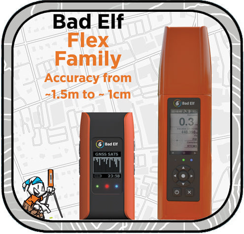

Bad Elf Flex: GNSS Game Changer
Bad Elf Flex GNSS delivers high-precision mapping at a fraction of the cost, with transparent pricing, no annual fees, free USA-based support, and seamless Bluetooth connectivity to any device. Shop now at Bad Elf Webstore or contact sales@bad-elf.com for a quote or trial!
-
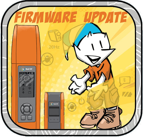

Flex Firmware Updates!
Last week we released a new version of the Bad Elf Flex app. This is mostly a maintenance release with minor bug fixes, but includes some behind-the-scenes updates that will give us a good foundation for new features coming in 2025!
-
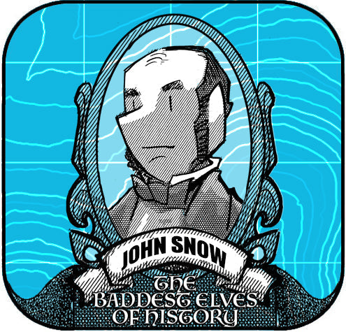

The Baddest Elves of History
John Snow, a pioneering 19th-century epidemiologist, revolutionized public health by using spatial mapping to trace the source of London's 1854 cholera outbreak. His innovative mapping of cholera cases around the Broad Street pump demonstrated the power of geographic analysis, laying the foundation for modern Geographic Information Systems (GIS). Snow’s work continues to influence epidemiology and GIS, showcasing the importance of spatial data in solving real-world challenges.
-
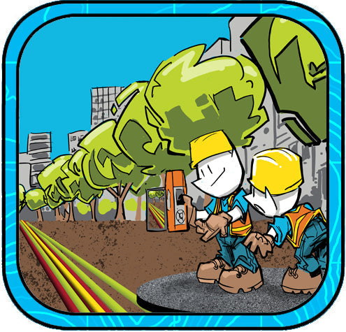

A Modern Solution for 3D Digital Twin and Augmented Reality
City utility workers can now locate buried assets with unmatched precision using the Bad Elf Flex Extreme GNSS receiver paired with the Pix4Dcatch app. This innovative solution combines centimeter-level GNSS accuracy, real-time 3D scanning, and augmented reality to superimpose GIS data onto live views for efficient field operations. By creating detailed 3D digital twins and enhancing workflows, this technology revolutionizes asset management and infrastructure maintenance.
-
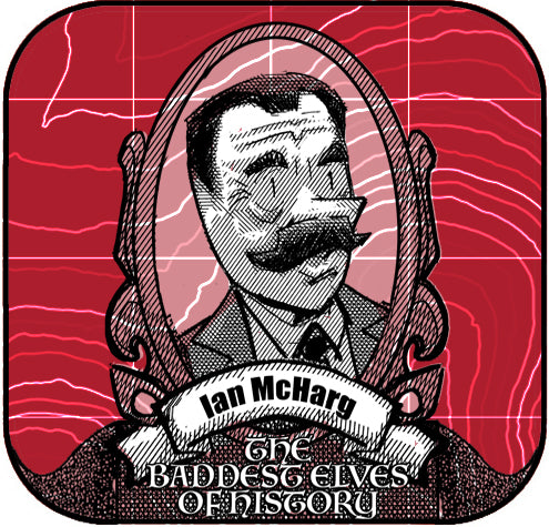

Ian McHarg: The Pioneer of Ecological Design
Discover Ian McHarg, the visionary landscape architect whose "layer cake" analysis method revolutionized landscape architecture, geography, and GIS development. His book Design with Nature laid the foundation for sustainable design and ecological planning, influencing modern practices and Esri founder Jack Dangermond. -


A Year-End Reflection from the Creators of HERE, HERE
The HERE HERE newsletter team reflects on nearly three years and 28 episodes of crafting geospatial content that blends education, humor, and creativity, celebrating our community with intentionally designed toons and cheesy jokes, while looking forward to many more years of fun and connection. -


Revolutionize Data Collection with Bad Elf and LTI
Discover how Bad Elf Flex GNSS technology seamlessly pairs with LTI TruPulse 360i and legacy laser rangefinders via Bluetooth, enabling accurate remote data collection in challenging environments. Safely capture x, y, z coordinates for busy intersections or utility pole heights without physical contact. Enhance safety, efficiency, and precision in your fieldwork with this powerful integration.
-
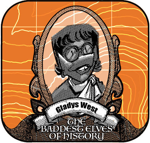

Baddest Elves of History - Gladys West
Gladys West's pioneering work on the mathematical modeling of the Earth's shape and satellite data analysis significantly enhanced GPS technology, enabling precise geospatial applications across various industries, and her legacy continues to influence modern tools like the Bad Elf Flex and inspire the geospatial community.
-
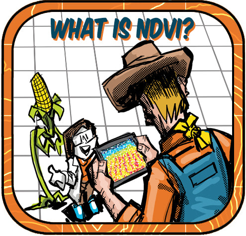

Understanding the Normalized Difference Vegetation Index (NDVI)
The article explains the Normalized Difference Vegetation Index (NDVI), highlighting its utility in assessing plant health through NIR and red light measurements from drones equipped with NIR cameras and GPS technologies like the Bad Elf Flex, which ensure precise mapping of vegetation data crucial for agricultural optimization and environmental monitoring.


