-
Terrestrial Scanning
- Portable, easy-to-use 3D scanning solutions for field professionals
Capture high-precision 3D models with ease!
Just walk around the object while the scanning kit does the work for you.
Designed for one-handed operation, built for fast, technician-friendly deployment in the field.

Underground Mapping

Inspection

Accident Reconstruction

Survey
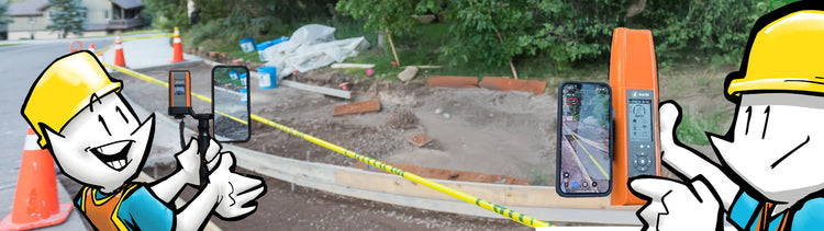
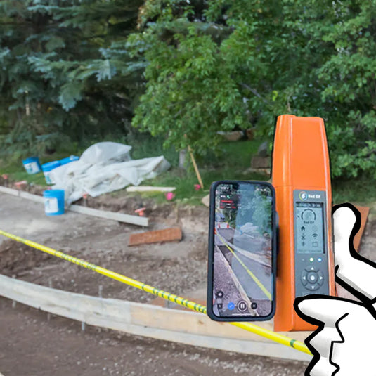
Terrestrial Scanning using your Phone and a Bad Elf GNSS Receiver
PIX4Dcatch enables professionals to create highly accurate 3D scans directly from your phone.
Bad Elf Flex Mini + PIX4Dcatch
High-accuracy scanning with minimal training. The Flex Mini Extreme offers centimeter GNSS accuracy out of the box and pairs instantly with PIX4Dcatch, making it the perfect solution for teams new to GNSS or photogrammetry.
- Plug-and-play Bluetooth connectivity with iPhones and iPads
- Lightweight, compact design for handheld or pole-mounted use
- PIX4Dcatch integration for easy 3D model capture
- No base station or complex setup required
- Field crews can be scanning in minutes—no prior experience needed
Flex Mini + PIX4Dcatch empowers technicians to collect accurate site data quickly and confidently, streamlining workflows across construction, inspection, and municipal mapping.
Bad Elf Flex + PIX4Dcatch
Professional-grade accuracy meets mobile simplicity. The Bad Elf Flex receiver delivers sub-centimeter GNSS precision when paired with PIX4Dcatch, enabling field teams to capture high-resolution 3D models without drones or base stations.
- RTK-capable GNSS for survey-grade accuracy
- Seamless Bluetooth pairing with iOS devices
- Compatible with PIX4Dcatch for photogrammetry and LiDAR workflows
- Ideal for CAD-ready deliverables and infrastructure mapping
- Built for rugged field deployment with all-day battery life
Whether you're scanning construction sites, utilities, or environmental features, Bad Elf Flex + PIX4Dcatch delivers precision and performance in a technician-friendly package.
