Access Denied
IMPORTANT! If you’re a store owner, please make sure you have Customer accounts enabled in your Store Admin, as you have customer based locks set up with EasyLockdown app. Enable Customer Accounts
 Vendors
 Spike is a laser measurement solution that allows you to measure an object simply by taking a photo with your smartphone or tablet. From that photo, you can capture real-time measurements including areas, elevations, distances between two points, and GPS/GNSS location. The Spike laser device, Spike mobile app, Spike Cloud and your smartphone or tablet work together to bring measurements within reach. When Spike is paired with the Bad Elf GPS receiver, the GPS accuracy of the mobile device is significantly improved delivering a simple, affordable measurement and mapping workflow.
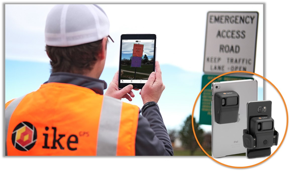
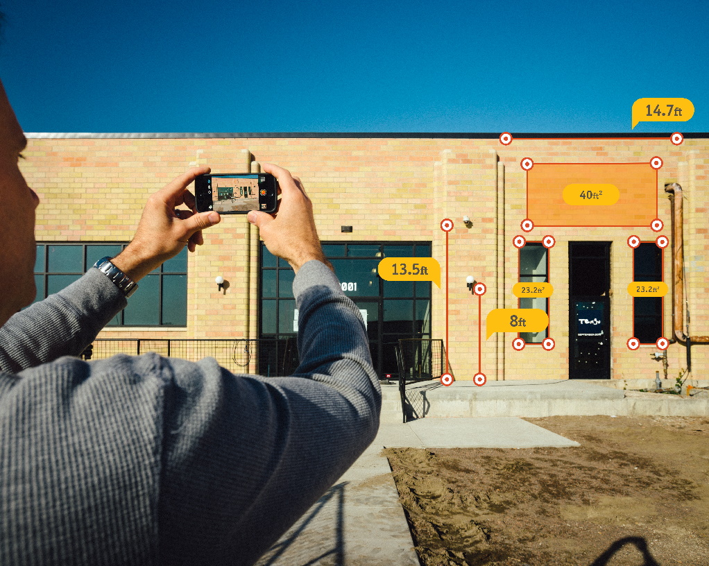
Photo Measurements
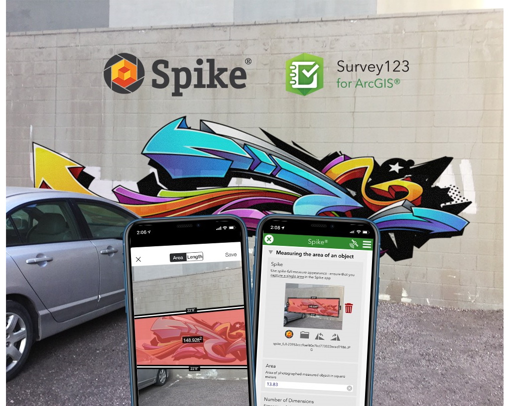
Spike and Survey123 for ArcGIS
Benefits/Improvements Since Integrating with Bad Elf
- Offset measurement capability for use with apps such as Esri Survey123
- Improved geolocation accuracy
Invalid password
Enter
Use left/right arrows to navigate the slideshow or swipe left/right if using a mobile device