SBG Systems is a world-leading manufacturer of innovative MEMS-based motion sensing solutions with its Headquarters in France and its subsidiaries in California and Singapore. SBG Systems designs, manufactures and markets a complete line of state-of-the-art inertial sensors such as Inertial Measurement Units (IMU), Attitude and Heading Reference Systems (AHRS), and Inertial Navigation Systems with embedded GNSS (INS/GNSS).
Covering the whole spectrum of surveying, from hydrography to mobile mapping and aerial cartography, SBG Systems offers a complete surveying solution including the IMU, Qinertia GNSS/INS PPK (post-processing kinematic) software as well as training and support.
Qinertia GNSS

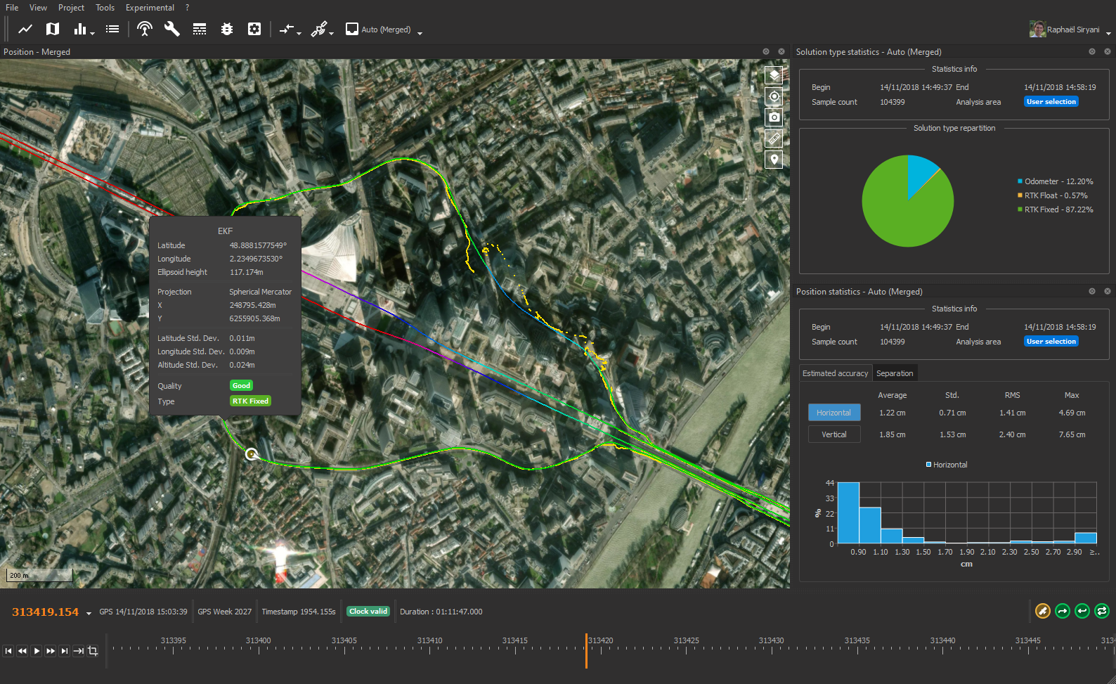
Qinertia is the Next-generation GNSS/INS Post-processing Solution available today. Developed in-house by SBG Systems, this fully-featured GNSS/INS post-processing software enhances GNSS-only or GNSS/IMU positioning performance by post-processing inertial data with raw GNSS observables. The Qinertia GNSS edition is capable of post-processing static and kinematic GNSS data from all GNSS receivers (through RINEX), it supports a growing number of popular geodetic datums and transformations as well as a range of GNSS processing approaches; Qinertia also supports photogrammetric surveys through the geotagging of images with precise position and orientations, and is upgradable at any time to an INS/GNSS processing license.
Features

+ 8,000 Base Stations always up-to-date
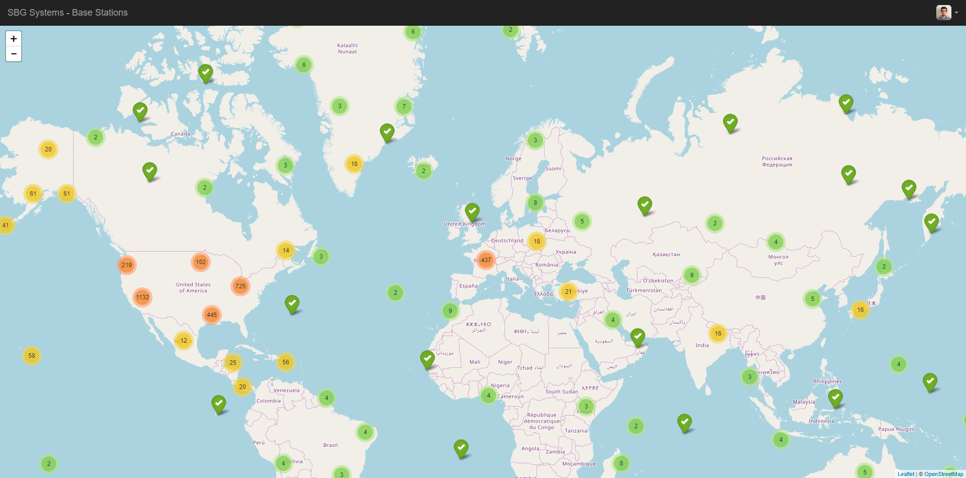
After the mission, Qinertia gives access to offline GNSS data from more than 8,000 base stations located in 164 countries - and always up-to-date.

Tightly Coupled Post-processing
Advanced tight coupling algorithm has been designed by SBG Systems to deliver the highest accuracy and maximize RTK availability.

Virtual Base Station (VBS)
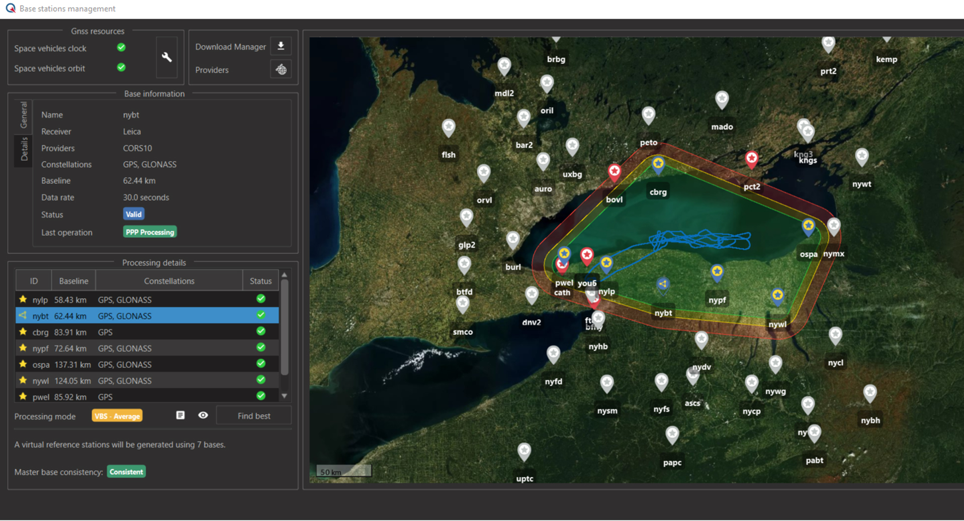
When you are far from a GNSS base station, Qinertia can automatically generate a Virtual Base Station (VBS). This VBS is created optimally for your trajectory in order to achieve the best position accuracy.

Image geo-tagging for Photogrammetry
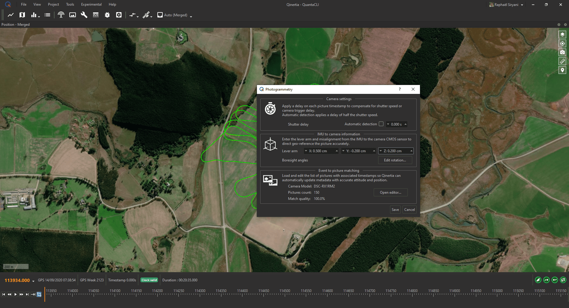
Qinertia simplifies the photogrammetry workflow by adding precise position and orientation to JPG images. All images can be previewed and easily edited before export. Qinertia accepts DJI P4 RTK native format and Matrice RTK with payload Zenmuse P1. Qinertia PPK software is fully compatible with RTK GNSS capable UAVs and photogrammetry suites including PIX4D, Agisoft, UAS Master, etc.
Contact Information
For more technical information visit the Qinertia web site
To request a quote or a trial license for Qinertia, contact Jack Mawson - Sales Director North America, SBG Systems

 Vendors