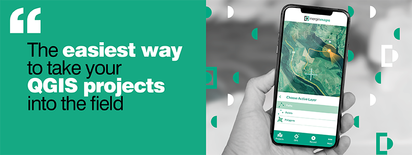
Skip to content
    • Login
    • Create Account
Bad Elf
  • Home
  • Industries
    • Aviation
    • Commercial Aviation
    • GIS/Mapping
    • Marine
    • Photography
  • Products
    • Bad Elf Flex Mini
    • Bad Elf Flex
    • Bad Elf Flex Base/Rover
    • Bad Elf Scanning Kit
    • Legacy Products
      • Plug-in GPS
      • Legacy Bluetooth GNSS Receivers
      • Wombat (Piston Edition)
      • Wombat (Turbine Edition)
    • Accessories
    • Correction Services
      • Point One Navigation
      • GEODNET
  • Solutions
    • App & Hardware Partners
    • Bad Elf App
    • Bad Elf Flex App
    • Compatible Apps
    • Education/Non-profit
    • Esri Solutions
    • Laser Offset Workflow
    • Geospatial Services
    • Pioneer Package
  • Support
    • Documents & Manuals
    • GIS Resources
    • RTN Map
    • Training Videos
    • Cleared to Update
    • Developer Portal
    • Knowledge Base
    • Glossary
    • Contact Us
  • Store
    • Bad Elf Store
    • GSA Products
    • Resellers
  • News & Press
    • Educational Articles
    • Events
    • General News
    • Here! Here! Newsletter
    • Testimonials
  • Product Collections
    • Flex Mini
    • Flex Mini Support Equipment
    • Flex
    • Flex Support Equipment
    • Accessories for Flex
    • Flex Tokens
    • Accessories for Bluetooth GPS
    • Apparel
Total $0.00 0
    • Product Collections Navigation
    • Flex Mini
    • Flex Mini Support Equipment
    • Flex
    • Flex Support Equipment
    • Accessories for Flex
    • Flex Tokens
    • Accessories for Bluetooth GPS
    • Apparel
  • Home
    • Industries Navigation
    • Aviation
    • Commercial Aviation
    • GIS/Mapping
    • Marine
    • Photography
    • Products Navigation
    • Bad Elf Flex Mini
    • Bad Elf Flex
    • Bad Elf Flex Base/Rover
    • Bad Elf Scanning Kit
      • Legacy Products Navigation
      • Plug-in GPS
      • Legacy Bluetooth GNSS Receivers
      • Wombat (Piston Edition)
      • Wombat (Turbine Edition)
    • Accessories
      • Correction Services Navigation
      • Point One Navigation
      • GEODNET
    • Solutions Navigation
    • App & Hardware Partners
    • Bad Elf App
    • Bad Elf Flex App
    • Compatible Apps
    • Education/Non-profit
    • Esri Solutions
    • Laser Offset Workflow
    • Geospatial Services
    • Pioneer Package
    • Support Navigation
    • Documents & Manuals
    • GIS Resources
    • RTN Map
    • Training Videos
    • Cleared to Update
    • Developer Portal
    • Knowledge Base
    • Glossary
    • Contact Us
    • Store Navigation
    • Bad Elf Store
    • GSA Products
    • Resellers
    • News & Press Navigation
    • Educational Articles
    • Events
    • General News
    • Here! Here! Newsletter
    • Testimonials
My Account
Access Denied
IMPORTANT! If you’re a store owner, please make sure you have Customer accounts enabled in your Store Admin, as you have customer based locks set up with EasyLockdown app. Enable Customer Accounts


Vendors

Mergin Maps

QGIS field survey app for seamless Geodata collaboration

Simplify field survey by capturing Geodata on your mobile or tablet. Create mobile forms with the fields you require and invite your survey teams to complete them on their phones or tablets. Captured data, along with their location can be surveyed offline, then synced back to the office in seconds.

Mergin Maps is an extension of the free and open source GIS software QGIS. It allows you to open, interrogate and edit your QGIS projects on your mobile. Map layers look the same as in QGIS desktop and you can sync your data back and forward with QGIS desktop using the Mergin Maps QGIS plugin.

Advantages of the Mergin Maps system:

  • No need for cables to get your data on/off your device
  • Connect to external GNSS devices for high accuracy location data
  • Wide selection of CRS with possible transformation and datum shift grids
  • Stake out and line recording utilising GPS
  • Share field survey with others for collaborative working
  • Safely work together on the same datasets, even offline
  • Updates from different surveyors are intelligently merged
  • Push data back from the field in real time
  • See version history and cloud-based backup
  • Fine-grained access control
  • Sync with your PostGIS datasets

Mergin Maps is developed by Lutra Consulting. With more than 14 years of experience helping organisations adopt open source GIS, we designed Mergin Maps to help solve challenges in a wide range of industries. Lutra Consulting is part of the core QGIS development team.

Learn More...

Invalid password
Enter
Contact Sales

Looking for advice on a product or service? Speak with a member of our staff.

Need Help?

We're here to help you with all of your Bad Elf products. Browse recent FAQ's, our Knowledge Base, Glossary, and more.

Support

Our staff is ready to assist with your detailed questions.

Quick links

  • Home
  • My Subscriptions
  • Newsletter
  • Support
  • Store
  • Blog
  • Careers
  • Contact
  • About Us

Policies

  • Accessory Warranty
  • GPS / Electronics Warranty
  • Hardware EULA
  • MAP Policy (US)
  • Privacy
  • Reseller Program
  • Returns
  • Shipping

Connect with us on Social Media

  • Facebook
  • Twitter
  • Instagram
  • LinkedIn
  • YouTube
Use left/right arrows to navigate the slideshow or swipe left/right if using a mobile device
  • Choosing a selection results in a full page refresh.
  • Press the space key then arrow keys to make a selection.

Shopping Cart

No products in the cart.