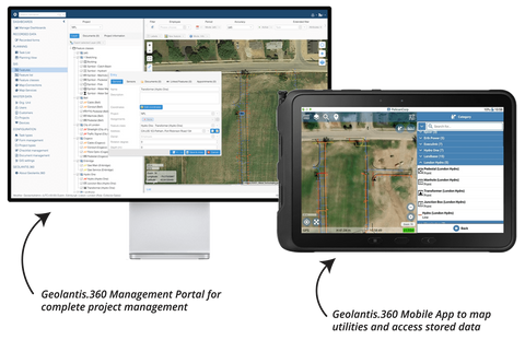
Geospatial Asset Data Collection + In-Depth Project Management
Geolantis.360 is a powerful geospatial asset data collection and management platform, based in the cloud. The solution integrates with Bluetooth-connected GNSS receivers, such as those provided by Bad Elf.
Say Goodbye to Postprocessing Work
Now you can quickly set up projects, communicate project details with your workforce, accurately map subsurface assets, and share this rich metadata with your clients—without the need for postprocessing work.
Geolantis.360 customers benefit from quick communication with clients. Many state it takes just minutes to upload the data and send the report to their clients, driving better client relationships. Since the data is stored digitally, it’s easy to access anytime—in the field or office.

Take Control of Your Locating Projects - From Start to Finish
The platform is built to help you manage a wide variety of projects while allowing you to define the exact field jobs you handle most. The platform is primed for you to manage:
- Projects, Locations & Workforce Management
- Field Forms & Checklists
- Devices & Equipment
- Project Documents
- Solution Administration
- Users & Qualifications
- Roles & Access Rights
- Custom Fields
- Built-in Feature Class Catalogues

Modernize Your Business
Geolantis.360 is a vendor-agnostic solution that integrates with your choice of GNSS and RTK devices. Built for flexibility, Geolantis.360 exports data compatible with GIS, CAD, and ERP databases, and can be used as a data management solution.
The possibilities are endless with Geolantis.360.

 Vendors
