Skip to content
    • Login
    • Create Account
Bad Elf
  • Home
  • Industries
    • Aviation
    • Commercial Aviation
    • GIS/Mapping
    • Marine
    • Photography
  • Products
    • Bad Elf Flex Mini
    • Bad Elf Flex
    • Bad Elf Flex Base/Rover
    • Bad Elf Scanning Kit
    • Legacy Products
      • Plug-in GPS
      • Legacy Bluetooth GNSS Receivers
      • Wombat (Piston Edition)
      • Wombat (Turbine Edition)
    • Accessories
    • Correction Services
      • Point One Navigation
      • GEODNET
  • Solutions
    • App & Hardware Partners
    • Bad Elf App
    • Bad Elf Flex App
    • Compatible Apps
    • Education/Non-profit
    • Esri Solutions
    • Laser Offset Workflow
    • Geospatial Services
    • Pioneer Package
  • Support
    • Documents & Manuals
    • GIS Resources
    • RTN Map
    • Training Videos
    • Cleared to Update
    • Developer Portal
    • Knowledge Base
    • Glossary
    • Contact Us
  • Store
    • Bad Elf Store
    • GSA Products
    • Resellers
  • News & Press
    • Educational Articles
    • Events
    • General News
    • Here! Here! Newsletter
    • Testimonials
  • Product Collections
    • Flex Mini
    • Flex Mini Support Equipment
    • Flex
    • Flex Support Equipment
    • Accessories for Flex
    • Flex Tokens
    • Accessories for Bluetooth GPS
    • Apparel
Total $0.00 0
    • Product Collections Navigation
    • Flex Mini
    • Flex Mini Support Equipment
    • Flex
    • Flex Support Equipment
    • Accessories for Flex
    • Flex Tokens
    • Accessories for Bluetooth GPS
    • Apparel
  • Home
    • Industries Navigation
    • Aviation
    • Commercial Aviation
    • GIS/Mapping
    • Marine
    • Photography
    • Products Navigation
    • Bad Elf Flex Mini
    • Bad Elf Flex
    • Bad Elf Flex Base/Rover
    • Bad Elf Scanning Kit
      • Legacy Products Navigation
      • Plug-in GPS
      • Legacy Bluetooth GNSS Receivers
      • Wombat (Piston Edition)
      • Wombat (Turbine Edition)
    • Accessories
      • Correction Services Navigation
      • Point One Navigation
      • GEODNET
    • Solutions Navigation
    • App & Hardware Partners
    • Bad Elf App
    • Bad Elf Flex App
    • Compatible Apps
    • Education/Non-profit
    • Esri Solutions
    • Laser Offset Workflow
    • Geospatial Services
    • Pioneer Package
    • Support Navigation
    • Documents & Manuals
    • GIS Resources
    • RTN Map
    • Training Videos
    • Cleared to Update
    • Developer Portal
    • Knowledge Base
    • Glossary
    • Contact Us
    • Store Navigation
    • Bad Elf Store
    • GSA Products
    • Resellers
    • News & Press Navigation
    • Educational Articles
    • Events
    • General News
    • Here! Here! Newsletter
    • Testimonials
My Account
Access Denied
IMPORTANT! If you’re a store owner, please make sure you have Customer accounts enabled in your Store Admin, as you have customer based locks set up with EasyLockdown app. Enable Customer Accounts
Digging Up the Past with High-Tech Pizzazz: How Bad Elf GNSS Makes Me a Geolocating Indiana Jones

Digging Up the Past with High-Tech Pizzazz: How Bad Elf GNSS Makes Me

March 8, 2024
Author Nikolas Smilovsky
Nikolas Smilovsky

Words: 456 | Reading Time: 5 Minutes

Ah, the thrill of the dig! 

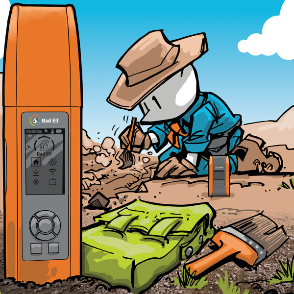
The sun beating down, the screech of eager trowels, and the possibility of unearthing a long-lost leviathan – what's not to love? But let's face it, paleontology isn't all about dashing through amber-laden jungles. There's meticulous data collection and that is where the magic of Bad Elf GNSS positioning devices comes in.

These little marvels are a paleontologist's dream – especially for those of us who frequent geologically interesting but geographically isolated corners of the globe. Forget lugging around clunky base stations – Bad Elf's base and rover solutions allow our team to collect high-accuracy data with remote ease. No more wrangling miles of cable in the Gobi Desert heat – just wander, waggle that nifty little antenna, and voila! Our finds are precisely tagged for posterity.

Now, you might be wondering, "Doc, why exactly do you need fancy gadgets to unearth dinosaur bones?" Here's the top five ways GNSS tech keeps this paleontologist happy:

  1. Precise Mapping: GPS technology allows for highly accurate mapping of dig sites. This ensures efficient excavation and minimizes the risk of overlooking valuable fossils.
  2. Stratigraphic Analysis: Detailed mapping of rock layers using GPS data helps paleontologists understand the chronological order of events at a dig site. This context is essential for piecing together the past environment.
  3. Fossil Documentation: Recording the precise location and orientation of each fossil with GPS is crucial. This data allows for accurate reconstruction of the creature's anatomy and movement patterns.
  4. 3D Visualization: GPS data can be used to create 3D models of excavation sites. These virtual environments enable researchers worldwide to remotely study and analyze discoveries.
  5. Standardized Data Sharing: Using standardized methods for GPS data collection facilitates seamless sharing of findings among paleontologists. This global collaboration accelerates our understanding of prehistoric life.

The next time you see a paleontologist sporting a peculiar Bad Elf GNSS antenna, don't scoff! That unassuming device is a powerful tool, silently aiding in the unearthing of Earth's ancient secrets. Want to delve deeper? Check out these resources on how positioning equipment is revolutionizing dinosaur discoveries:

  • Using Drones and GIS in Paleontology
  • Mapping Australia’s Dinosaur Landscape
  • High-resolution GPS/GIS-based 3D mapping and spatial analysis of in situ fossils in two horned-dinosaur bonebeds in the Dinosaur Park Formation (Upper Cretaceos) at Dinosaur Provincial Park, Alberta, Canada

Bad Elf Flex Mini Product Page
Bad Elf Geospatial Enablement Team
Bad Elf Flex Product Page
  • 3D modeling
  • Dinosaur fossils
  • Flex
  • Flex Mini
  • Fossil location
  • GNSS
  • GPS
  • High-accuracy
  • MARCH2024
  • Paleontological fieldwork
  • Paleontology
  • remote data collection
  • Stratigraphy
  • Share on Facebook
  • Tweet on Twitter
  • Pin on Pinterest

Nikolas Smilovsky
Nikolas Smilovsky

Dr. Smilovsky is the Geospatial Solutions Director for Bad Elf, a GNSS technologies company. Dr S is a faculty member at Arizona State University teaching various GIS and design classes. He is a certified Geographic Information Systems Professional, a certified Arborist, and a Part 107 certified UAV pilot. As a geospatial evangelist, custom geospatial solutions provider, and geographic researcher Dr. S is widely versed in all things geodetic. He is a proud Geoholic!

Invalid password
Enter
Contact Sales

Looking for advice on a product or service? Speak with a member of our staff.

Need Help?

We're here to help you with all of your Bad Elf products. Browse recent FAQ's, our Knowledge Base, Glossary, and more.

Support

Our staff is ready to assist with your detailed questions.

Quick links

  • Home
  • My Subscriptions
  • Newsletter
  • Support
  • Store
  • Blog
  • Careers
  • Contact
  • About Us

Policies

  • Accessory Warranty
  • GPS / Electronics Warranty
  • Hardware EULA
  • MAP Policy (US)
  • Privacy
  • Reseller Program
  • Returns
  • Shipping

Connect with us on Social Media

  • Facebook
  • Twitter
  • Instagram
  • LinkedIn
  • YouTube
Use left/right arrows to navigate the slideshow or swipe left/right if using a mobile device
  • Choosing a selection results in a full page refresh.
  • Press the space key then arrow keys to make a selection.

Shopping Cart

No products in the cart.