Skip to content
    • Login
    • Create Account
Bad Elf
  • Home
  • Industries
    • Aviation
    • Commercial Aviation
    • GIS/Mapping
    • Marine
    • Photography
  • Products
    • Bad Elf Flex Mini
    • Bad Elf Flex
    • Bad Elf Flex Base/Rover
    • Bad Elf Scanning Kit
    • Legacy Products
      • Plug-in GPS
      • Legacy Bluetooth GNSS Receivers
      • Wombat (Piston Edition)
      • Wombat (Turbine Edition)
    • Accessories
    • Correction Services
      • Point One Navigation
      • GEODNET
  • Solutions
    • App & Hardware Partners
    • Bad Elf App
    • Bad Elf Flex App
    • Compatible Apps
    • Education/Non-profit
    • Esri Solutions
    • Laser Offset Workflow
    • Geospatial Services
    • Pioneer Package
  • Support
    • Documents & Manuals
    • GIS Resources
    • RTN Map
    • Training Videos
    • Cleared to Update
    • Developer Portal
    • Knowledge Base
    • Glossary
    • Contact Us
  • Store
    • Bad Elf Store
    • GSA Products
    • Resellers
  • News & Press
    • Educational Articles
    • Events
    • General News
    • Here! Here! Newsletter
    • Testimonials
  • Product Collections
    • Flex Mini
    • Flex Mini Support Equipment
    • Flex
    • Flex Support Equipment
    • Accessories for Flex
    • Flex Tokens
    • Accessories for Bluetooth GPS
    • Apparel
Total $0.00 0
    • Product Collections Navigation
    • Flex Mini
    • Flex Mini Support Equipment
    • Flex
    • Flex Support Equipment
    • Accessories for Flex
    • Flex Tokens
    • Accessories for Bluetooth GPS
    • Apparel
  • Home
    • Industries Navigation
    • Aviation
    • Commercial Aviation
    • GIS/Mapping
    • Marine
    • Photography
    • Products Navigation
    • Bad Elf Flex Mini
    • Bad Elf Flex
    • Bad Elf Flex Base/Rover
    • Bad Elf Scanning Kit
      • Legacy Products Navigation
      • Plug-in GPS
      • Legacy Bluetooth GNSS Receivers
      • Wombat (Piston Edition)
      • Wombat (Turbine Edition)
    • Accessories
      • Correction Services Navigation
      • Point One Navigation
      • GEODNET
    • Solutions Navigation
    • App & Hardware Partners
    • Bad Elf App
    • Bad Elf Flex App
    • Compatible Apps
    • Education/Non-profit
    • Esri Solutions
    • Laser Offset Workflow
    • Geospatial Services
    • Pioneer Package
    • Support Navigation
    • Documents & Manuals
    • GIS Resources
    • RTN Map
    • Training Videos
    • Cleared to Update
    • Developer Portal
    • Knowledge Base
    • Glossary
    • Contact Us
    • Store Navigation
    • Bad Elf Store
    • GSA Products
    • Resellers
    • News & Press Navigation
    • Educational Articles
    • Events
    • General News
    • Here! Here! Newsletter
    • Testimonials
My Account
Access Denied
IMPORTANT! If you’re a store owner, please make sure you have Customer accounts enabled in your Store Admin, as you have customer based locks set up with EasyLockdown app. Enable Customer Accounts
NAD27 demonstration map

NAD27 - We’re Not in Kansas Anymore

April 8, 2024
Author Nikolas Smilovsky
Nikolas Smilovsky

Words: 508 | Reading Time: 5 Minutes

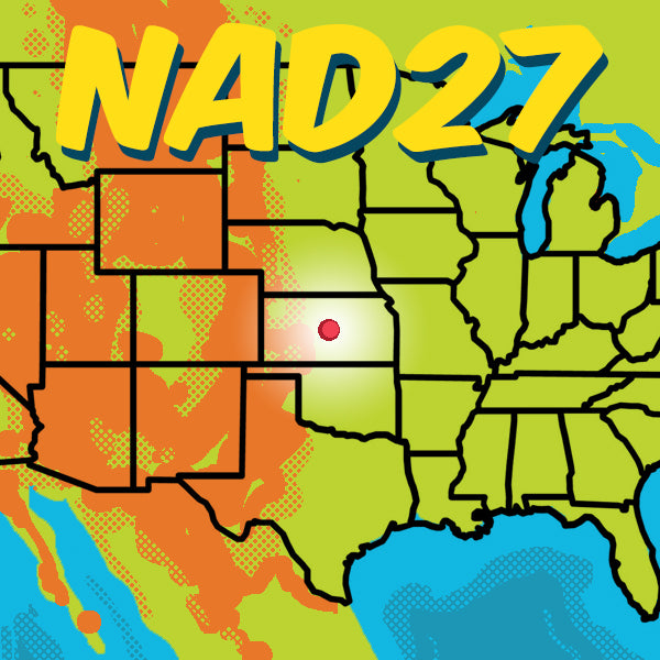
The Genesis in Kansas

In the heartland of America, under the expansive skies of Meades Ranch, Kansas, an epic geodetic journey began in the early 20th century. This is the story of the North American Datum of 1927 (NAD27), a foundational element in the field of mapping and surveying that would shape the way we understand our world.

Origin Story: It all started at Meades Ranch in Kansas, where the geodetic center of the United States was believed to reside. This single, unassuming point became the heartbeat of NAD27, serving as its initial reference.

Technical Marvel: The genius of NAD27 lay in its triangulation method, using thousands of survey markers spread across the continent. These markers were painstakingly measured and connected to create a vast, interconnected network.

The Mechanisms of NAD27

The Geodetic Framework: NAD27 was constructed using the Clarke Ellipsoid of 1866, a mathematical model that approximates the shape of the Earth. By assuming a fixed Earth-centered ellipsoid, NAD27 provided a uniform reference for mapping the continent.

Importance Unveiled: This datum was revolutionary. It allowed for consistent, accurate mapping across diverse terrains, from the rolling hills of the East to the rugged landscapes of the West. Land surveyors, cartographers, and GIS professionals could now speak a common geospatial language.

The Evolution to NAD83

As time marched on, so too did technology and understanding. The limitations of NAD27 became apparent, giving rise to its successor: the North American Datum of 1983 (NAD83).

A Leap Forward: NAD83 shifted the geodetic center and adopted a new ellipsoid, the Geodetic Reference System of 1980 (GRS80), which better reflected the Earth's shape.

Precision Enhanced: With the advent of satellites and advancements in geodesy, NAD83 offered improved accuracy and uniformity, crucial for the burgeoning field of GNSS (Global Navigation Satellite System) mapping.

The Dawn of NATRF2022

Yet, the odyssey doesn't end with NAD83. The horizon promises a new chapter with the North American Terrestrial Reference Frame of 2022 (NATRF2022).

Future-Proofing Geodesy: NATRF2022 is poised to harness the latest in geodetic science and satellite technology, offering unprecedented accuracy for future mapping endeavors.

The Legacy and Beyond

Indispensable Tools: NAD27, NAD83, and the forthcoming NATRF2022 are not mere coordinates on a map. They are the invisible frameworks upon which our understanding of the physical world is built. 

A Geospatial Symphony: For GIS professionals, land surveyors, and mappers wielding GNSS technology, these datums are the notes that create harmony in the vast symphony of spatial data.

The journey from NAD27, starting at a solitary point in Kansas, to NAD83, and looking ahead to NATRF2022, is a testament to human ingenuity and the relentless pursuit of precision in understanding our world. It's a story of how we, as a species, have striven to chart the unknown, ensuring that every point on our maps brings us closer to the truth of our shared spaces. If you would like to know more about datums please watch this video on our Bad Elf YouTube channel or please email us at GET@bad-elf.com to talk with one of our geospatial enablement specialists. 


Bad Elf Flex Mini Product Page
Bad Elf Geospatial Enablement Team
Bad Elf Flex Product Page
  • APRIL2024
  • coordinate systems
  • datum
  • Geodesy
  • geography
  • gis
  • gnss
  • gps
  • land surveying
  • mapping
  • NAD27
  • NAD83
  • NATRF2022
  • Share on Facebook
  • Tweet on Twitter
  • Pin on Pinterest

Nikolas Smilovsky
Nikolas Smilovsky

Dr. Smilovsky is the Geospatial Solutions Director for Bad Elf, a GNSS technologies company. Dr S is a faculty member at Arizona State University teaching various GIS and design classes. He is a certified Geographic Information Systems Professional, a certified Arborist, and a Part 107 certified UAV pilot. As a geospatial evangelist, custom geospatial solutions provider, and geographic researcher Dr. S is widely versed in all things geodetic. He is a proud Geoholic!

Invalid password
Enter
Contact Sales

Looking for advice on a product or service? Speak with a member of our staff.

Need Help?

We're here to help you with all of your Bad Elf products. Browse recent FAQ's, our Knowledge Base, Glossary, and more.

Support

Our staff is ready to assist with your detailed questions.

Quick links

  • Home
  • My Subscriptions
  • Newsletter
  • Support
  • Store
  • Blog
  • Careers
  • Contact
  • About Us

Policies

  • Accessory Warranty
  • GPS / Electronics Warranty
  • Hardware EULA
  • MAP Policy (US)
  • Privacy
  • Reseller Program
  • Returns
  • Shipping

Connect with us on Social Media

  • Facebook
  • Twitter
  • Instagram
  • LinkedIn
  • YouTube
Use left/right arrows to navigate the slideshow or swipe left/right if using a mobile device
  • Choosing a selection results in a full page refresh.
  • Press the space key then arrow keys to make a selection.

Shopping Cart

No products in the cart.