
Newsletter
Categories
- All topics
- 3D modeling
- accessory
- accuracy
- Accurate Survey Data
- AEC
- aerial
- affordable
- Agents of Discovery
- analysis
- Apglos Survey Wizard
- APRIL2024
- ArcGIS
- architecture
- As-built
- AUG2023
- aviation
- awareness
- Bad Elf
- Bad Elf GPS
- base
- base/rover
- Bluetooth
- breaks
- buffer
- Christmas
- community
- Compliance
- Conference
- constellations
- construction
- construction professionals
- consultation
- coordinate systems
- Cost Effective Surveying
- Cost Savings
- Custom GIS Solutions
- Custom Integration
- data collection
- datum
- DEC2023
- Digital Asset Mapping
- Dinosaur fossils
- Drone
- drones
- Education
- Efficient Land Surveys
- enablement
- engineering
- Esri
- Extreme Accuracy
- fatalities
- FEB2024
- Field Maps
- field workers
- Flex
- Flex Mini
- Fossil location
- frequency
- GCP
- GCT
- Geodesy
- geography
- geomatics
- geoprocessing
- geospatial
- Geospatial Data
- Geospatial Enablement Team
- GET
- gis
- GIS Training
- GNSS
- GPS
- GPS data collection
- GPS Integration
- ground control
- ground control targets
- Ground Penetrating Radar
- hazards
- High Precision Survey
- high-accuracy
- injuries
- JAN2024
- jingle bells
- JULY2023
- JUNE2023
- land surveying
- land surveyors
- Laser
- LiDAR
- Mapping
- MARCH2024
- math
- MAY2023
- NAD27
- NAD83
- NATRF2022
- Newsletter
- NMEA
- NOV2023
- oct2023
- Operations Optimization
- Paleontological fieldwork
- Paleontology
- planes
- planning
- portable
- PPE
- Precise Mapping
- prevention
- radio
- Rangefinder
- real-time data collection
- remote data collection
- rover
- RTK
- Safety
- Safety Optimization
- safety tips
- SDK
- SEPT2023
- Sign Management Solution
- signals
- solutions
- song
- Stratigraphy
- support
- survey-grade
- Surveying Technology
- total stations
- training
- Tree Inventory
- Tree Management Solution
- User Friendly Survey App
- utility design
- UTM
- WGS-84
- workplace safety
-
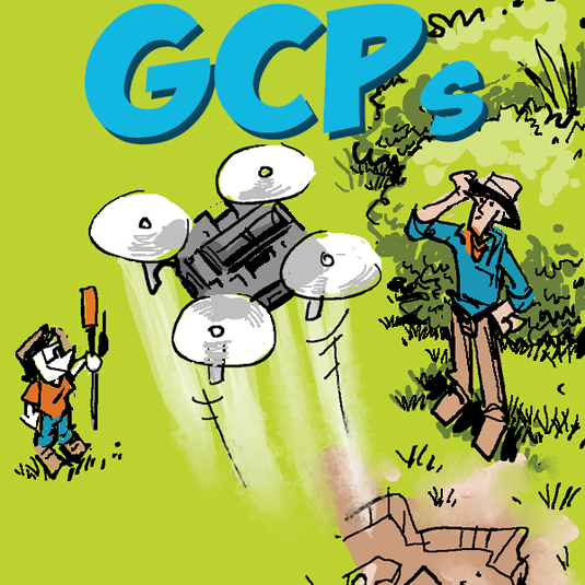

Hitting the Target: Setting Ground Control with Bad Elf Flex

Setting ground control targets with the Bad Elf Flex GNSS significantly enhances the accuracy of drone data collection. This method ensures aerial survey data is precise, reliable, and aligns with real-world coordinates.
-

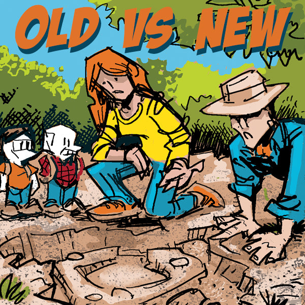
Evolution of Land Survey Techniques - From Analog to Digital
The Bad Elf Flex and Flex Mini GNSS receivers epitomize the transition to digital surveying, offering unparalleled precision, efficiency, and ease of use for modern surveying professionals. These devices support multiple GNSS constellations and provide real-time correction capabilities, revolutionizing land surveying and GIS applications. -
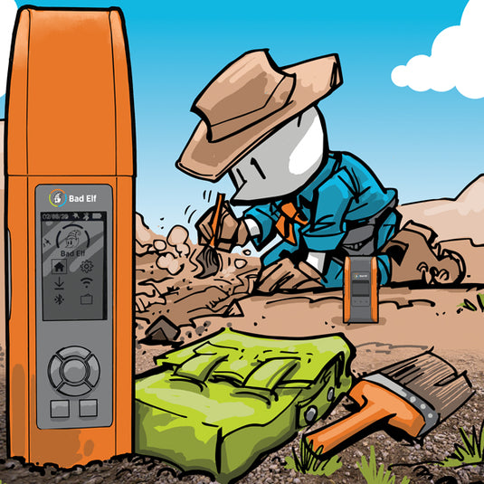

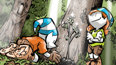
Digging Up the Past with High-Tech Pizzazz: How Bad Elf GNSS Makes Me a Geolocating Indiana Jones
Forget lugging around clunky base stations – Bad Elf's base and rover solutions allow our team to collect high-accuracy data with remote ease. No more wrangling miles of cable in the Gobi Desert heat – just wander, waggle that nifty little antenna, and voila! Our finds are precisely tagged for posterity.
-


One Size Fits All: The Flex GNSS Family
The Bad Elf Flex family line of GNSS receivers meet all your various geospatial needs.
-


Land Survey Magic with Apglos Survey Wizard and Bad Elf
The integration of Apglos Survey Wizard with Bad Elf GPS offers a cost-effective, user-friendly, and highly accurate solution for land surveying, making it a dream combination for professionals seeking efficiency and precision.
-

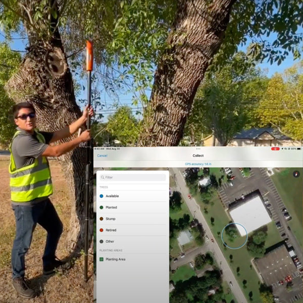
Parks and Recreation: Master Tree Management
Advanced ArcGIS Tree Management solution using the Bad Elf Flex GNSS receiver. Simplify tree inventory, inspections, and maintenance, while providing invaluable insights for informed decision-making -

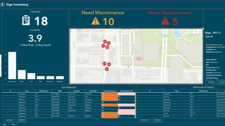
Sign Management for Local Governments
Empower your municipality with the Bad Elf GNSS and the Esri ArcGIS Online Sign Management solution. Say goodbye to paper maps and outdated databases as we transition your workflow to a digital platform with our hardware and training services.
-

Tree Inventory
Tree inventories hold significant importance for organizations, communities, and individuals due to the numerous benefits that trees provide to the environment. -


Laser Offsets
Using high-accuracy Bad Elf GPS integrated with a laser offset rangefinder is an exceptional method for collecting remote data due to several key advantages. -
March 2023 Newsletter - HERE, HERE!
In this newsletter we cover topics that include
- Datums
- Custom Esri ArcGIS Fields for Field Maps and QuickCapture
- Bad Elf Ortho Everywhere tool
- Tilt filtered points
-
January 2023 Newsletter - HERE, HERE!
Bad Elf now offers the ability to record the correct elevation in both the attribute table and geometry of ArcGIS Online features through a simple workflow.


