The most comprehensive GPS app experience, yet.
.
Design
To build a new app, we started from the beginning, so the first thing we did was create a fresh new design, color scheme, and layout that's optimized for every device that runs iOS 8.

User Interface & User Experience
You'll notice a brand new user interface that's cleaner and easier to navigate. The user experience now has far fewer swipes, taps, boops, and swoops.


Built for iOS 8
We optimized the look and feel of the new app from the ground up with iOS 8 in mind. The new app is designed meticulously to take full advantage of the larger screen of the iPad, iPhone 6 and iPhone 6 Plus in all orientations.
Simplified Trip Management
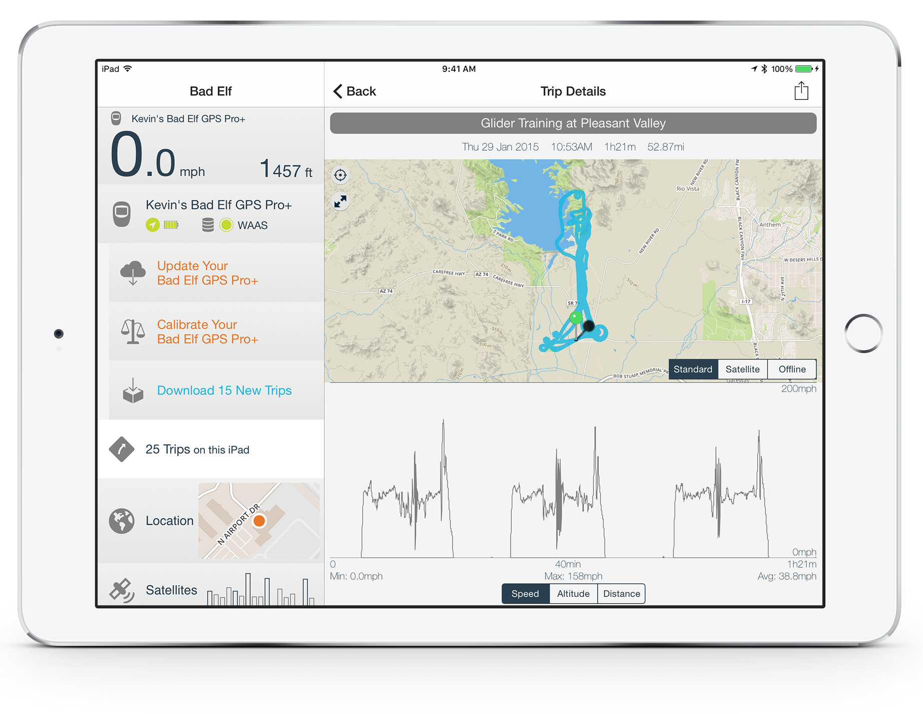
We know our users love recording their adventures with the trip datalogger, and the new app is designed to help you quickly transfer new logs from your Bad Elf GPS unit to your iOS device. After transfer, you can see your trips plotted on a map view or visualize them on speed/altitude/distance graphs.


Where Are You Going? Where Have You Been?
We re-engineered how you download and manage trips from your Bad Elf GPS devices. The new app will automatically tell you how many new trips you have on your Bad Elf GPS that are not on your iOS device and allow you to download a single trip at a time or all of them all at once; saving you time and effort.
All the Detail Imaginable
Once trips are saved, we analyze your trip and plot it on a gorgeous map and graph important details such as changes in altitude, distance and speed.

Deviation Plot View for the Bad Elf GNSS Surveyor
We've created a new view specifically for our GNSS Surveyor that plots your position and horizontal accuracy over time. This is handy for visualizing the reported accuracy and position converge down to 1 meter or better, depending on sky visibility and your geographic location. The plot's center point can be configured to be a known benchmark, a weighted average of historical points, or the last reported position.


Share Trips to Facebook & Twitter
How many times have you been on an adventure only to have your excitement ruined by not being able to tell your Facebook/Twitter friends about it? Fear not! Now you can share a map of your trip directly to your Facebook or Twitter feeds without leaving the app using iOS's built-in share sheets.
Live Gauges for Bad Elf GPS Accessories
High accuracy gauges monitor your connected devices in real-time. Fun fact: they also monitor your internal GPS if you don't have a Bad Elf connected - but you should, because that's why we're here.

Real-Time, All the Time
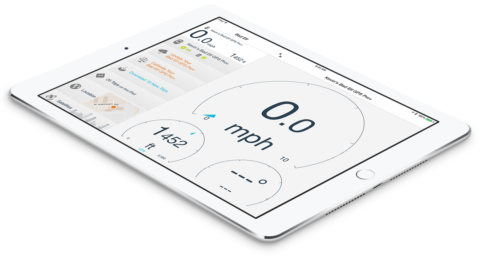
Our high-accuracy live gauges show you the real-time speed, heading and altitude of any connected Bad Elf GPS accessory right on your iOS device. Gauges also show you the trend of each measurement so you can really tell how fast you're moving.
Day/Night Mode
Wrapping up a trip at night has never looked so good and not ruined your night vision. Easily switch between Day and Night mode in Settings to change the entire app's user-interface to a custom color layout that won't hurt your eyes without the need to change your screen brightness where apparently, some of you like to work (or fly) at night or in the dark, so we built in a fancy night mode so the iPad screen brightness (roughly equal to the power of the Sun^1000) doesn't burn out your eyes.


Safe and Sound, from Dusk 'Til Dawn
Wrapping up a trip at night has never looked so good and not ruined your night vision. Easily switch between Day and Night mode in Settings to change the entire app's user-interface to a custom color layout that won't hurt your eyes without the need to change your screen brightness.
Improved Offline Maps
What's worse than having no Internet connection? Having a slow Internet connection. We feel your pain and have updated our cached offline maps with state and country level zoom levels so you can see your current position and trips regardless of Internet connectivity.

The new app features a custom offline map even if your iPhone or iPad is never connected to the internet. No downloading required to view state and country level anywhere in the world. When you have an internet connection, no need to configure anything, the new app will automatically load the standard and satellite maps for you when needed.

